Stensbaek Plantage
Theme: Soils and klimpes (wet sand dunes) Locality: Stensbaek Plantage
Description of a Danish GeoSite
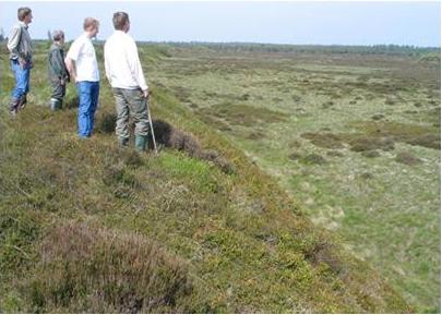
Photo: H. Breuning-Madsen, Visitors viewing from edge of klimpe.
Primary identification
1. GeoSite no.:
GS - 11-2.
2. National locality no.:
NGI - n.a.
3. GeoSite name:
Stensbaek Plantation.
4. Location:
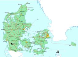
Denmark, S�nderjylland (Southern Jutland).
5. Co-ordinates UTM:
System ED50, Zone 32, x=, y=
6. Type of locality:
Klimpe.
Primary geological features
7. Main topic:
The genesis of the Klimpe landform.
8. Geo(morpho)logy:
The main pedology in this outwash plain, covered with aeolian dune sand, West of the main stationary line for the Weichselian Ice age is podzolization. In some podzols strongly cemented spodic horizons have developed, some with thin iron pans. These are impeding the percolation of the precipitation water surplus, and small moorlands have developed.
Due to farming probably in the late iron age and at medieval time severe wind erosion occurred and sand from the well drained fields blew into the moorlands, where it was deposited due to the wet condition. Thus dunes with wet cores (klimper) were developed. Several klimpes exist in Stensbaek plantation. They are delimited by very streep slopes covered in heather vegetation. The central part of the klimpe is its lowest part, where wetland plant communities may be found. In winter the central part of the klimpe may be covered by water.
See also detailed photo and map under the heading "26. Supplemenatry description".
9. Frame / context:
Pedology, Sedimentology, Geomorphology.
10. Chronostratigraphy:
Post glacial, South Scandinavian iron age, and Recent.
11. Primary value:
Dune landscape formed by wind erosion, pedology and farming.
12. Comparative evaluation:
The klimpes at Stensbaek are prominent and the most well exposed.
13. Comparable GeoSites:
In Denmark: Froeslev plantation.
Outside Denmark: Northern Germany and Holland.
Supplementary data in support of the locality
14. Delineation on a map:
15. Higth of the GeoSite:
5m (relative to the surroundings).
16. Area of the GeoSite:
The area with klimpes is about 5 km2.
17. Subordinate geological interests:
Temporary hanging aquifers.
18. "Non"-geo interests:
Spare time resort. Cultural history.
19. References:
C. Stenz and R.P. S�rensen (1969): Bov Sogn. Historisk Samfund for Bov Sogn.
R. P. S�rensen (1971): Iagttagelser I jyske indsander. Dansk Geologisk Forenings Aarsskrift 1971: 5-26.
20. Data sources, collections:
Profile description and soil analyses are available in the Danish soil profile and analytical database at Faculty of Agricultural Sciences, Aarhus University, Foulum.
21. Illustrations:
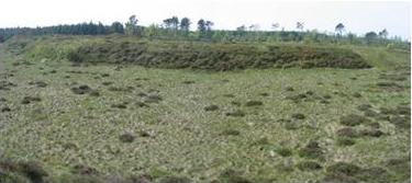
Photo: H. Breuning-Madsen, Characteristic medium sized klimpe.
22. Proposers:
Dansk Geologisk Forening & Det Kongelige Danske Geografiske Selskab/H. Breuning-Madsen.
23. Description by:
H.Breuning-Madsen.
24. Recommandation:
Selected to be a GeoSite.
25. Comments: So soon as an international description has been published Stensbaek will become the main example og af klimpe.
26. Supplementary description:
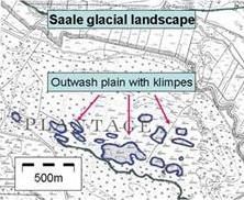 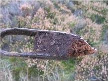
Detailed map highlighting klimpes. Drill sample with sand over spagnum peat. Photo: H. Breuning-Madsen
|
[an error occurred while processing this directive]
List
Theme: Soils and klimpers (wet sand dunes)
 |
